31) Quoting “Zetetic Cosmogeny” Thomas Winships states: “Let ‘imagination’ picture to the mind what force air would have which was set in motion by a spherical body of 8,000 miles in diameter, which in one hour was spinning round 1,000 mph, rushing through space at 65,000 mph and gyrating across the heavens? Then let ‘conjecture’ endeavor to discover whether the inhabitants on such a globe could keep their hair on? If the earth-globe rotates on its axis at the terrific rate of 1,000 miles an hour, such an immense mass would of necessity cause a tremendous rush of wind in the space it occupied. The wind would go all one way, and anything like clouds which got ‘within the sphere of influence’ of the rotating sphere, would have to go the same way. The fact that the earth is at rest is proved by kite flying.”
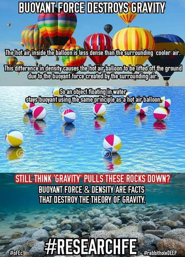
Things settle downward by way of buoyancy and density and it's medium. According to the whirling ball theory there is no up or down only towards the ball. But reality shows us differently.
32) If “gravity” is credited with being a force strong enough to hold the world’s oceans, buildings, people and atmosphere stuck to the surface of a rapidly spinning ball, then it is impossible for “gravity” to also simultaneously be weak enough to allow little birds, bugs, and planes to take-off and travel freely unabated in any direction.
33) If “gravity” is credited with being a force strong enough to curve the massive expanse of oceans around a globular Earth, it would be impossible for fish and other creatures to swim through such forcefully held water.
34) Ship captains in navigating great distances at sea never need to factor the supposed curvature of the Earth into their calculations. Both Plane Sailing and Great Circle Sailing, the most popular navigation methods, use plane, not spherical trigonometry, making all mathematical calculations on the assumption that the Earth is perfectly flat. If the Earth were in fact a sphere, such an errant assumption would lead to constant glaring inaccuracies. Plane Sailing has worked perfectly fine in both theory and practice for thousands of years, however, and plane trigonometry has time and again proven more accurate than spherical trigonometry in determining distances across the oceans.
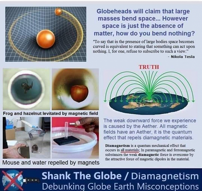
How can you bend or warp space and time? One is a concept and the other is literally nothing. Neither has any properties.
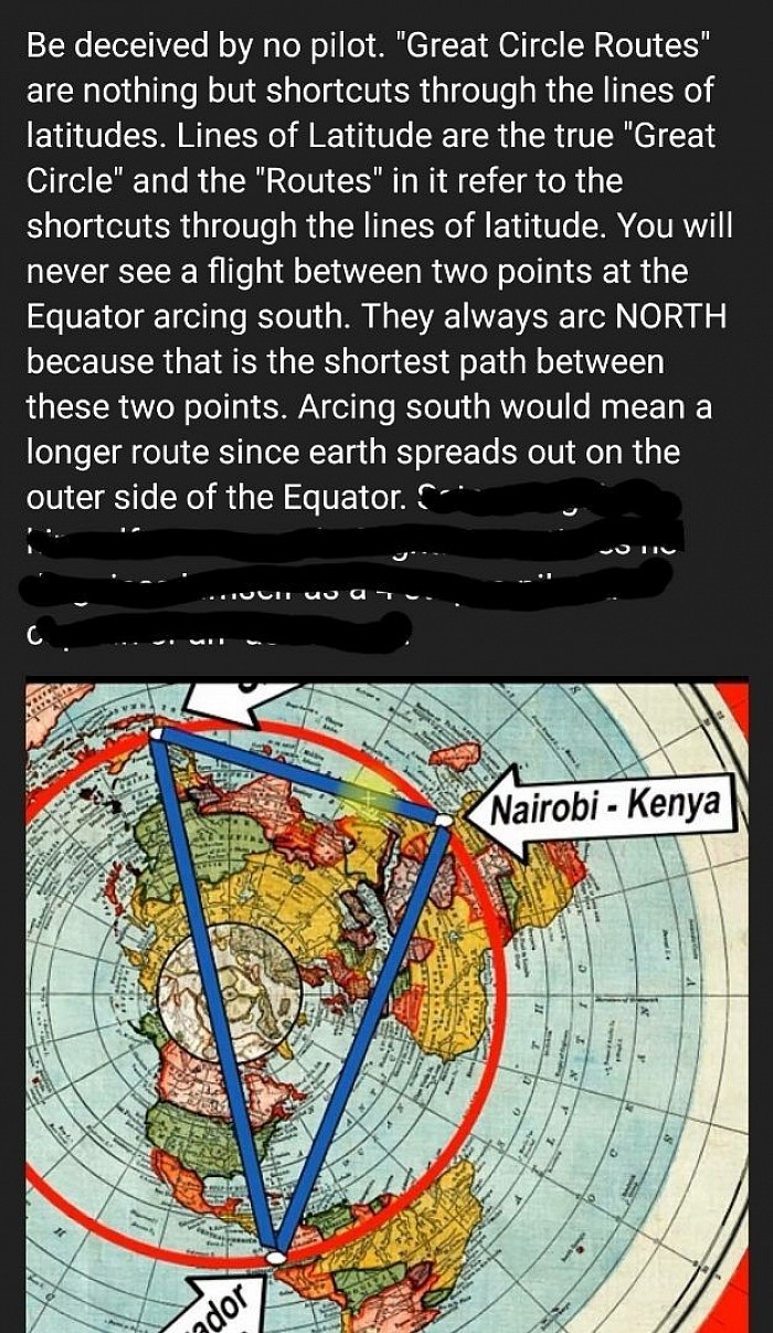
35) If the Earth were truly a globe, then every line of latitude south of the equator would have to measure a gradually smaller and smaller circumference the farther South travelled. If, however, the Earth is an extended plane, then every line of latitude south of the equator should measure a gradually larger and larger circumference the farther South travelled. The fact that many captains navigating south of the equator assuming the globular theory have found themselves drastically out of reckoning, moreso the farther South travelled, testifies to the fact that the Earth is not a ball.
36) During Captain James Clark Ross’s voyages around the Antarctic circumference, he often wrote in his journal perplexed at how they routinely found themselves out of accordance with their charts, stating that they found themselves an average of 12-16 miles outside their reckoning every day, later on further south as much as 29 miles.
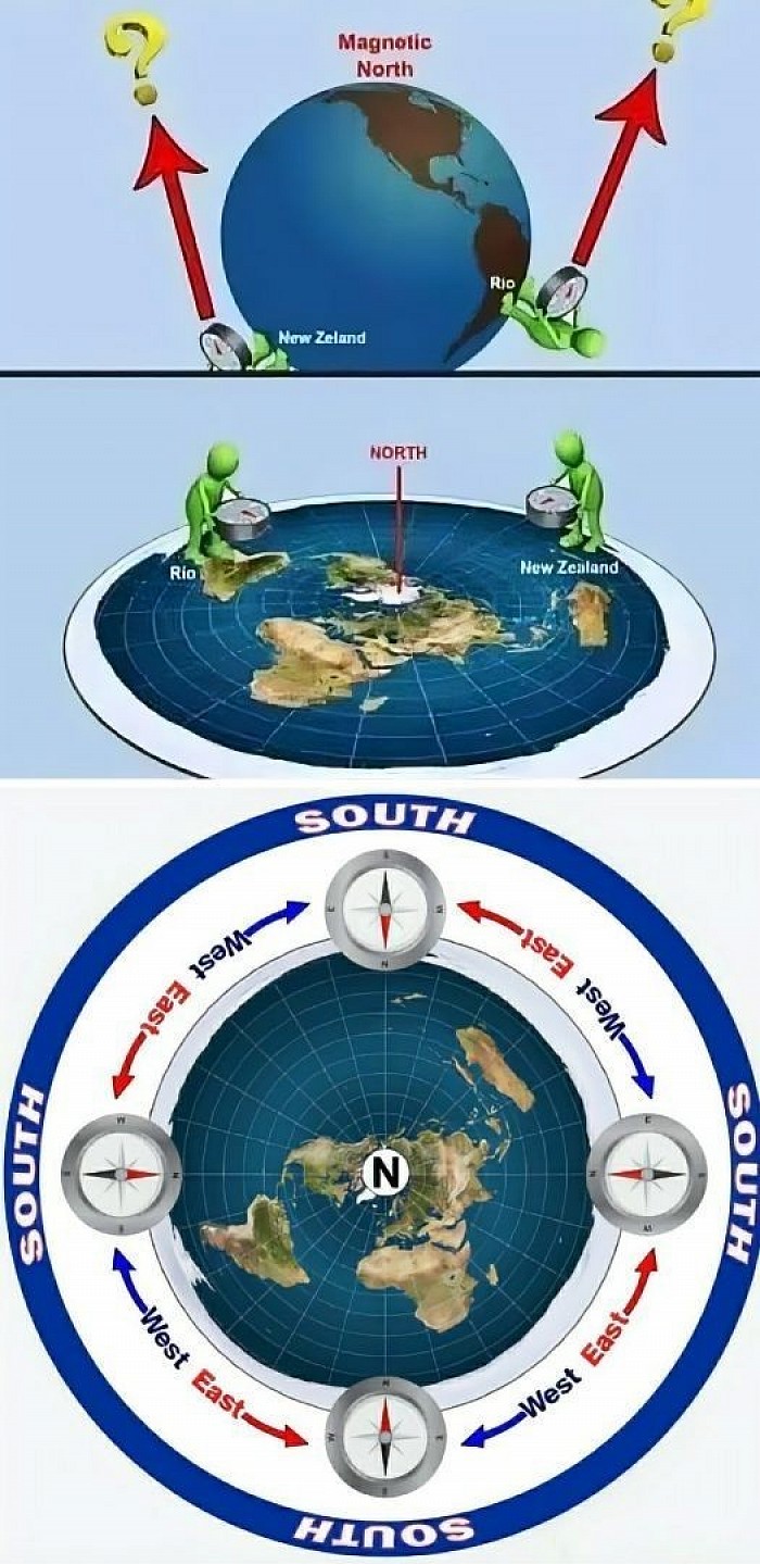
Put a small stick on a ball and pretend the top of the ball is North. Now move the stick around, does it point to the top or "space"? A compass must be laid flat on your hand to work
37) Lieutenant Charles Wilkes commanded a United States Navy exploration expedition to the Antarctic from 1838 to 1842, and in his journals also mentioned being consistently east of his reckoning, sometimes over 20 miles in less than 18 hours.
38) To quote Reverend Thomas Milner, “In the southern hemisphere, navigators to India have often fancied themselves east of the Cape when still west, and have been driven ashore on the African coast, which, according to their reckoning, lay behind them. This misfortune happened to a fine frigate, the Challenger, in 1845. How came Her Majesty’s Ship ‘Conqueror,’ to be lost? How have so many other noble vessels, perfectly sound, perfectly manned, perfectly navigated, been wrecked in calm weather, not only in dark night, or in a fog, but in broad daylight and sunshine - in the former case upon the coasts, in the latter, upon sunken rocks - from being ‘out of reckoning?’” The simple answer is that Earth is not a ball.
No curvature no ball.
39) Practical distance measurements taken from “The Australian Handbook, Almanack, Shippers’ and Importers’ Directory” state that the straight line distance between Sydney and Nelson is 1550 statute miles. Their given difference in longitude is 22 degrees 2’14”. Therefore if 22 degrees 2’14” out of 360 is 1550 miles, the entirety would measure 25,182 miles. This is not only larger than the ball-Earth is said to be at the equator, but a whole 4262 miles greater than it would be at Sydney’s southern latitude on a globe of said proportions.
40) From near Cape Horn, Chile to Port Philip in Melbourne, Australia the distance is 10,500 miles, or 143 degrees of longitude away. Factoring in the remaining degrees to 360 makes for a total distance of 26,430 miles around this particular latitude, which is over 1500 miles wider than Earth is supposed to be at the equator, and many more thousands of miles wider than it is supposed to be at such Southern latitudes.
41) Similar calculations made from the Cape of Good Hope, South Africa to Melbourne, Australia at an average latitude of 35.5 degrees South, have given an approximate figure of over 25,000 miles, which is again equal to or greater than the Earth’s supposed greatest circumference at the equator. Calculations from Sydney, Australia to Wellington, New Zealand at an average of 37.5 degrees South have given an approximate circumference of 25,500 miles, greater still! According to the ball-Earth theory, the circumference of the Earth at 37.5 degrees Southern latitude should be only 19,757 statute miles, almost six thousand miles less than such practical measurements.
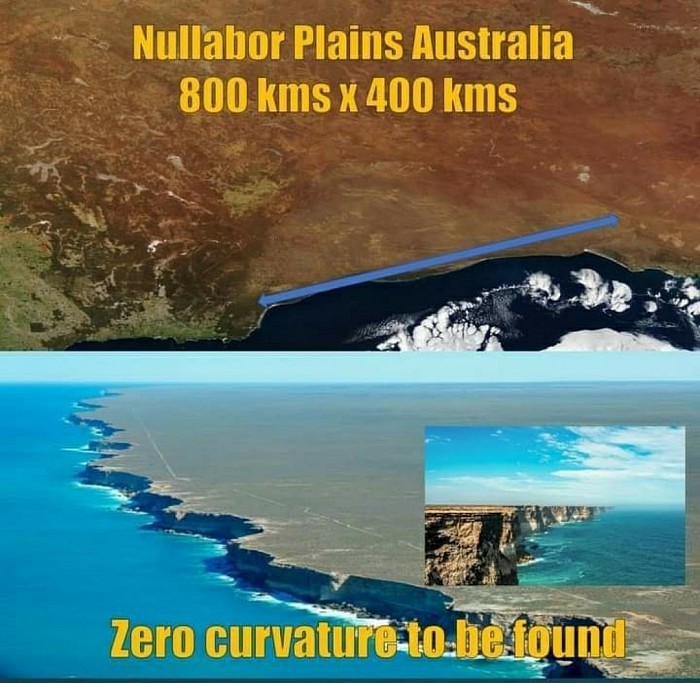
Proof of no downward curvature literally everywhere.
Observable proof everywhere.
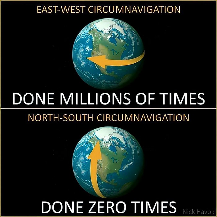
42) In the ball-Earth model Antarctica is an ice continent which covers the bottom of the ball from 78 degrees South latitude to 90 and is therefore not more than 12,000 miles in circumference. Many early explorers including Captian Cook and James Clark Ross, however, in attempting Antarctic circumnavigation took 3 to 4 years and clocked 50-60,000 miles around. The British ship Challenger also made an indirect but complete circumnavigation of Antarctica traversing 69,000 miles. This is entirely inconsistent with the ball model.
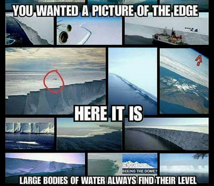
Everywhere you go south you have the Antarctica wall.
43) If Earth was a ball there are several flights in the Southern hemisphere which would have their quickest, straightest path over the Antarctic continent such as Santiago, Chile to Sydney, Australia. Instead of taking the shortest, quickest route in a straight line over Antarctica, all such flights detour all manner of directions away from Antarctica instead claiming the temperatures too cold for airplane travel! Considering the fact that there are plenty of flights to/from/over Antarctica, and NASA claims to have technology keeping them in conditions far colder (and far hotter) than any experienced on Earth, such an excuse is clearly just an excuse, and these flights aren’t made because they are impossible.
This only makes sense on a flat earth.
Satellites
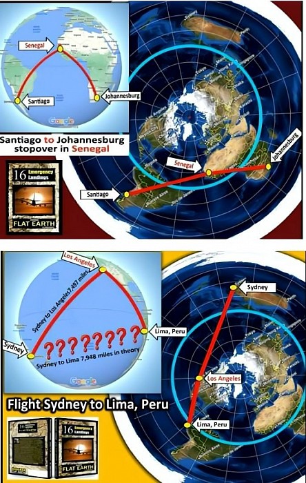
44) If Earth was a ball, and Antarctica was too cold to fly over, the only logical way to fly from Sydney to Santiago would be a straight shot over the Pacific staying in the Southern hemisphere the entire way. Re-fueling could be done in New Zealand or other Southern hemisphere destinations along the way if absolutely necessary. In actual fact, however, Santiago-Sydney flights go into the Northern hemisphere making stop-overs at LAX and other North American airports before continuing back down to the Southern hemisphere. Such ridiculously wayward detours make no sense on the globe but make perfect sense and form nearly straight lines when shown on a flat Earth map.
Emergency landings of flights that only makes sense on a flat earth.
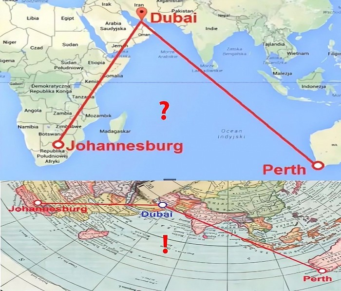
45) On a ball-Earth, Johannesburg, South Africa to Perth, Australia should be a straight shot over the Indian Ocean with convenient re-fueling possibilities on Mauritus or Madagascar. In actual practice, however, most Johannesburg to Perth flights curiously stop over either in Dubai, Hong Kong or Malaysia all of which make no sense on the ball, but are completely understandable when mapped on a flat Earth.
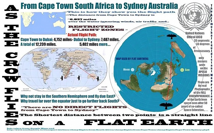
46) On a ball-Earth Cape Town, South Africa to Buenos Aries, Argentina should be a straight shot over the Atlantic following the same line of latitude across, but instead every flight goes to connecting locations in the Northern hemisphere first, stopping over anywhere from London to Turkey to Dubai. Once again these make absolutely no sense on the globe but are completely understandable options when mapped on a flat Earth.
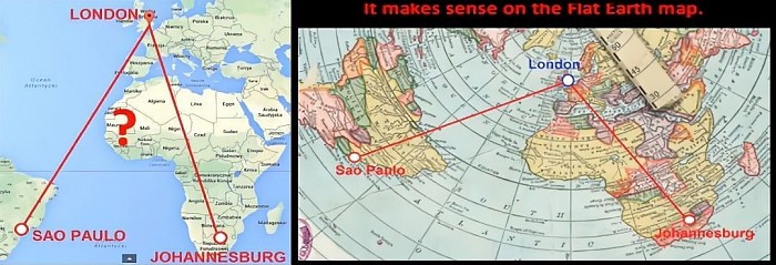
47) On a ball-Earth Johannesburg, South Africa to Sao Paolo, Brazil should be a quick straight shot along the 25th Southern latitude, but instead nearly every flight makes a re-fueling stop at the 50th degree North latitude in London first! The only reason such a ridiculous stop-over works in reality is because the Earth is flat.
48) On a ball-Earth Santiago, Chile to Johannesburg, South Africa should be an easy flight all taking place below the Tropic of Capricorn in the Southern hemisphere, yet every listed flight makes a curious re-fueling stop in Senegal near the Tropic of Cancer in the North hemisphere first! When mapped on a flat Earth the reason why is clear to see, however, Senegal is actually directly in a straight-line path half-way between the two.
49) If Earth were a spinning ball heated by a Sun 93 million miles away, it would be impossible to have simultaneously sweltering summers in Africa while just a few thousand miles away bone-chilling frozen Arctic/Antarctic winters experiencing little to no heat from the Sun whatsoever. If the heat from the Sun traveled 93,000,000 miles to the Sahara desert, it is absurd to assert that another 4,000 miles (0.00004%) further to Antarctica would completely negate such sweltering heat resulting in such drastic differences.
50) If the Earth were truly a globe, the Arctic and Antarctic polar regions and areas of comparable latitude North and South of the equator should share similar conditions and characteristics such as comparable temperatures, seasonal changes, length of daylight, plant and animal life. In reality, however, the Arctic/Antarctic regions and areas of comparable latitude North/South of the equator differ greatly in many ways entirely inconsistent with the ball model and entirely consistent with the flat model.
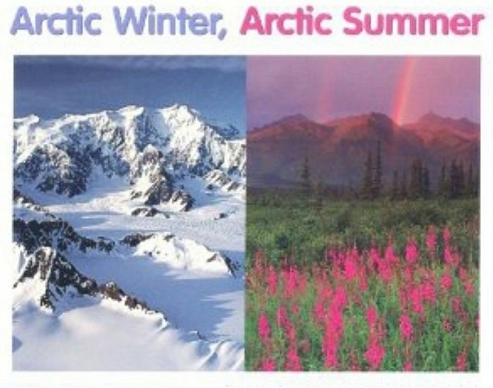
51) Antarctica is by far the coldest place on Earth with an average annual temperature of approximately -57 degrees Fahrenheit, and a record low of -135.8! The average annual temperature at the North Pole, however, is a comparatively warm 4 degrees. Throughout the year, temperatures in the Antarctic vary less than half the amount at comparable Arctic latitudes. The Northern Arctic region enjoys moderately warm summers and manageable winters, whereas the Southern Antarctic region never even warms enough to melt the perpetual snow and ice. On a tilting, wobbling, ball-Earth spinning uniformly around the Sun, Arctic and Antarctic temperatures and seasons should not vary so greatly.
52) Iceland at 65 degrees North latitude is home to 870 species of native plants and abundant various animal life. Compare this with the Isle of Georgia at just 54 degrees South latitude where there are only 18 species of native plants and animal life is almost non-existent. The same latitude as Canada or England in the North where dense forests of various tall trees abound, the infamous Captain Cook wrote of Georgia that he was unable to find a single shrub large enough to make a toothpick! Cook wrote, “Not a tree was to be seen. The lands which lie to the south are doomed by nature to perpetual frigidness - never to feel the warmth of the sun’s rays; whose horrible and savage aspect I have not words to describe. Even marine life is sparse in certain tracts of vast extent, and the sea-bird is seldom observed flying over such lonely wastes. The contrasts between the limits of organic life in Arctic and Antarctic zones is very remarkable and significant.”
Let's continue to the next page shall we.
